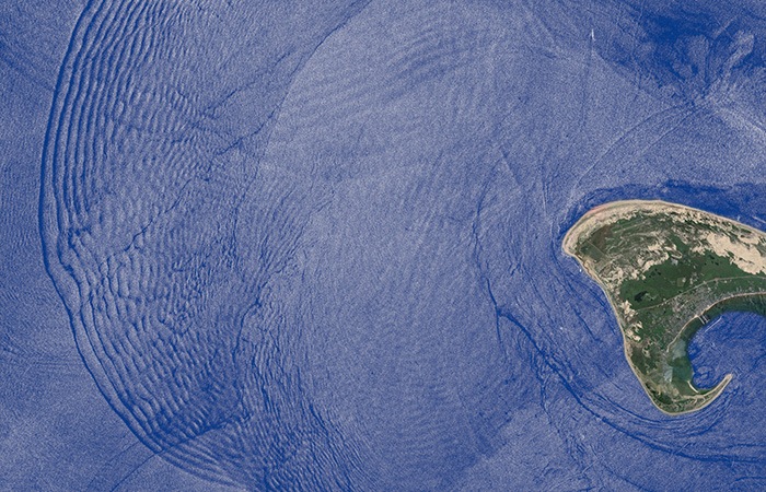
Satellite imagery shows alernating dark and light bands of smooth and rough waters formed at the ocean surface by an internal wave propagating deeper in the depths. The internal wave is rippling into Cape Cod Bay between the tip of Cape Cod and Stellwagen Bank, a shallow underwater bank to the north. (José da Silva/University of Porto in Portugal and the German Aerospace Center’s TerraSAR-X satellite superimposed on map by Google Earth, SIO, NOAA, U.S. Navy, NGA, GEBCO, U.S. Geological Survey, TerraMetricks)

