• About
  • Research
  • Education
  • News
  • Events
  • People
  • Opportunities
  • Support Oceans At MIT

Oceans at MIT

Striving to understand, harness and sustain Earth's defining frontier.

Geotraces cruise track

Published on October 9, 2012 in Geotraces: Building a Periodic Table for the OceanFull resolution ( × )
← Previous Next →

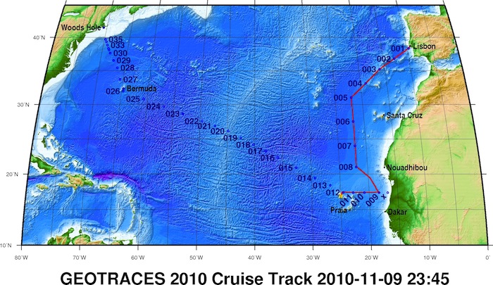
A map of the North Atlantic Transect cruise track. The red line shows the stations occupied from October 15 to November 4, 2010. The second half of the cruise stretched between the Cape Verde Islands and Woods Hole, from November 6 to December 12, 2011. Credit: WHOI

oceansatmit@gmail.com
Visit Us On FacebookVisit Us On Twitter