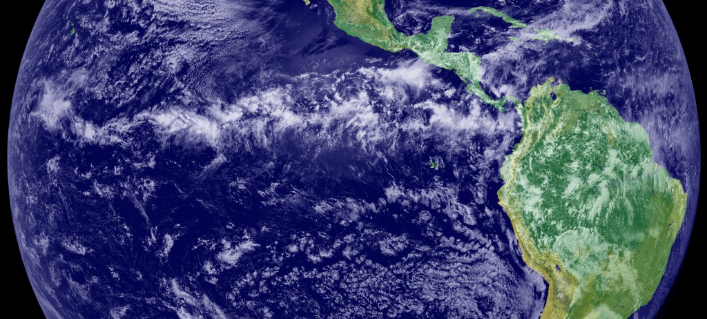
This image is a combination of cloud data from NOAA’s Geostationary Operational Environmental Satellite (GOES-11) and color land cover classification data. The ITCZ is the band of bright white clouds that cuts across the center of the Earth. (Photo: NOAA’s GOES Project Science Office)

